
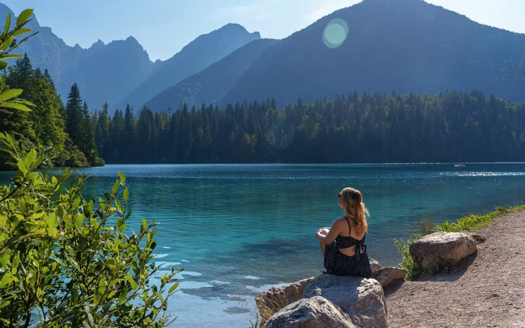
There are places where walking is not just movement, but an experience. In Friuli Venezia Giulia, the north easternmost region of Italy – a land of silence, mirrors of water, deep forests and high altitudes – a slow hiking itinerary takes shape that captures the true essence of the mountains. A network of trails unfolds around the region’s alpine lakes and small mountain ponds, guiding visitors through ever-changing landscapes: from the pastures of Carnia to the majestic peaks of the Julian Alps, from dolomitic rock formations to the gentler, more accessible settings of valleys and foothill basins. This is an offer aimed at a wide range of audiences (experienced hikers, families, and backpackers seeking nature or wellbeing away from the crowds) and that combines the beauty of the landscape with the large variety of biodiversity, history, and local traditions. In the new “trekking and lakes” section of the official website, visitors can find 19 itineraries designed to enjoy the mountains step by step.
Glacial lakes, lush basins, charming mountain huts, and breathtaking views make Friuli Venezia Giulia one of Europe’s most surprising Alpine regions. From west to east, a wide variety of hikes stretches across the Alpine and pre-Alpine areas of the Italy region, varying in altitude, distance, and accessibility. Each route includes detailed information on starting points, directions, trail characteristics, landscape features, and recommended equipment, as well as useful references to mountain huts, maps, and signage. Furthermore, the Friuli Venezia Giulia Outdoor app, designed to support these experiences, provides access to an interactive map with detailed route descriptions and photos, as well as useful tips for planning excursions. The app allows users to create and share their own experiences with other passionate people and to keep track of their progress.
5 must-see hiking trails in Friuli Venezia Giulia
For those looking for an easy yet scenic itinerary, the Lake Barcis loop is an ideal choice close to the Friulan Dolomites. The route – along which the Giro d’Italia will run along on Saturday, May 30, during the Gemona-Piancavallo stage – winds around the well-known artificial lake created by the construction of the Ponte Antoi dam. It features cycling and walking paths, footbridges, rest areas and views over the canyon of Forra del Cellina. The hike reaches the Village of Barcis, crosses meadows and deciduous forests and includes a stretch of the Alpini Trail, with picturesque views over the Caltea stream. Suitable for everyone, it is perfect for families or those approaching hiking in a stunning natural setting. Distance: 5.6 km; duration: 2 hours; minimal elevation gain.
2. Sauris: alpine huts and glacial lakes
A wide-ranging itinerary unfolds from Sauris di Sopra – named Best Tourism Village 2022 by the UNWTO – towards Sella di Festons: it crosses a large plateau with alpine huts and pristine glacial lakes, offering ever-changing views over the Dolomiti Pesarine. The route continues through pastures and mountain passes, touching Casera Festons, Malga Malino, Casera Vinadia Grande and Forcella Pieltinis, with a 360-degree view over the Sauris relaxing landscape, characterized by its quiet nature and open horizons, as well as alpine majestic scenarios. This route is longer and more demanding: it is suited to experienced hikers. Distance: 10.1 km; duration: 4 hours 10 minutes; elevation gain: 861 metres.
On the Olbe plateau, beneath the jagged ridge stretching from Mount Righile to Mount Ferro, three crystal-clear glacial lakes lie nestled among grassy knolls, small basins and high-altitude pastures. The farthest east lake is the most striking one, with its vivid green waters which reflect the dramatic white rock towers. This trekking requires good fitness and includes a steep ascent, but rewards hikers with unique views and increasingly dream landscapes toward the end. Distance: 4.6 km; duration: about 3 hours; elevation gain: 937 metres.
Among the notable routes there is the panoramic loop around Tarond and Crasulina Lakes, appealing for those seeking a mindful yet accessible high-altitude trekking. The trail leads towards two glacial lakes set among open pastures, grassy ridges and breathtaking alpine views, just below the ridge connecting Monte Crostis to Zoufplan. Fed by melting snow and surrounded by meadows and rhododendrons, the lakes offer one of the most authentic landscapes of the Carnic Alps – ideal for a refreshing break and for experiencing the mountains in a peaceful and serene atmosphere. Hikers can also enrich the experience by observing typical alpine flora along with significant remnants from World War II, combining nature with history. The loop is classified as moderate difficulty: 9 km, approximately 3 hours 30 minutes, with just over 300 metres of elevation gain.
5. Sella Sompdogna Pond: nature and memory in the Julian Alps
Easy and short yet highly evocative, the route to Sella Sompdogna Lake is ideal for those seeking full immersion in the alpine environment. Driving up the Val Dogna to the saddle parking area, the trail then leads through larch and fir forests to a small hidden lake formed in a glacial basin. The pond is home to some amphibian species and insects of great natural interest, as well as fascinating historic remains. Along the route, hikers will observe remnants from World War, including trenches and fortified positions. The hike also gives you the opportunity to reach the “Fratelli Grego” hut, from which you can enjoy a scenic view of the dramatic faces of the Julian Alps. Distance: 2.2 km; duration: 50 minutes; elevation gain: 123 metres.
These five itineraries represent only part of the hiking trails near the lakes offered by PromoTurismoFVG. Together, they tell the story of a region where the mountains can be experienced authentically, through activities that combine outdoor life, direct contact with unspoiled nature, wellbeing, landscape, and culture.